3D Coordinate System Guide: Types, XYZ Models & Applications
A 3D coordinate system is a mathematical framework that uses three perpendicular axes to define any point’s location in three-dimensional space. Unlike 2D systems that use only X and Y coordinates, 3D coordinate systems incorporate a third Z-axis, enabling precise positioning of objects in height, width, and depth. This fundamental concept powers everything from computer graphics and engineering design to architectural modeling and scientific visualization across the United States and globally.
What is the 3D Coordinate System
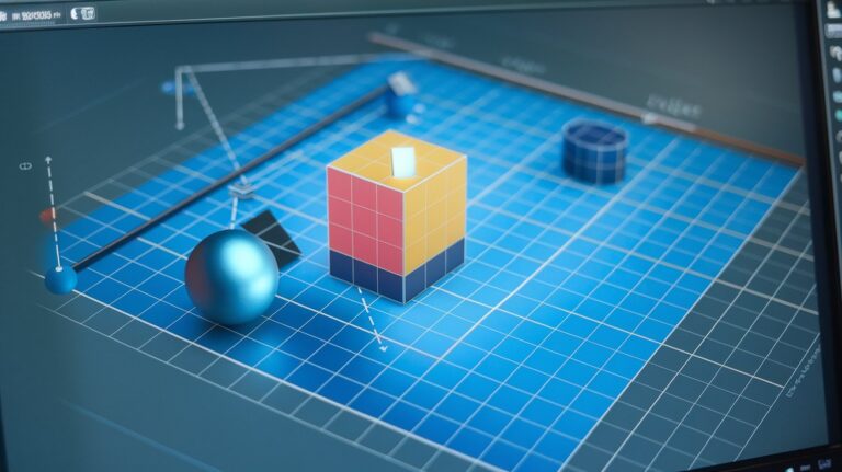
The 3D coordinate system extends traditional 2D coordinate geometry by adding a third dimension through the Z-axis. This system allows mathematicians, engineers, and computer scientists to represent any point in three-dimensional space using an ordered triple (x, y, z). Each coordinate represents the point’s distance along its respective axis from the origin point (0, 0, 0).
In the United States, educational institutions from high schools to universities teach 3D coordinate systems as part of advanced mathematics curricula. The coordinate system forms the backbone of numerous industries including aerospace engineering at NASA, automotive design in Detroit, and entertainment technology in Hollywood. Modern applications range from GPS navigation systems that track elevation to virtual reality environments that create immersive 3D worlds.
The 4 Types of Coordinate Systems
Understanding different types of coordinate systems is crucial for various mathematical and engineering applications. Each system offers unique advantages depending on the specific problem or geometric shape being analyzed.
Cartesian Coordinate System
The Cartesian coordinate system represents the most common type, using three perpendicular axes labeled X, Y, and Z. Named after mathematician René Descartes, this system forms the foundation for most 3D modeling software used across American industries. Points are expressed as (x, y, z) where each value represents distance along its respective axis from the origin.
Cylindrical Coordinate System
The cylindrical coordinate system uses radius (r), angle (θ), and height (z) to define positions. This system proves particularly useful in engineering applications involving circular or cylindrical objects, such as designing oil drilling equipment or manufacturing pipes. American petroleum companies frequently utilize cylindrical coordinates for wellbore positioning and trajectory planning.
Spherical Coordinate System
The spherical coordinate system employs radius (r), polar angle (θ), and azimuthal angle (φ) to locate points. This system excels in astronomy, satellite communication, and radar applications. NASA extensively uses spherical coordinates for spacecraft navigation and planetary orbit calculations, making it essential for America’s space exploration programs.
Homogeneous Coordinate System
The homogeneous coordinate system adds a fourth coordinate (w) to standard 3D coordinates, creating (x, y, z, w) representations. This system simplifies matrix transformations in computer graphics and robotics. Silicon Valley tech companies leverage homogeneous coordinates in 3D rendering engines and augmented reality applications, contributing billions to the US economy annually.
XYZ Coordinate System in 3D Models
The XYZ coordinate system serves as the standard framework for 3D modeling across industries. In this system, the X-axis typically represents horizontal movement (left-right), the Y-axis represents vertical movement (up-down), and the Z-axis represents depth (forward-backward). This convention varies slightly between different software applications and industries.
American manufacturing companies rely heavily on XYZ coordinate systems for computer-aided design (CAD) and computer numerical control (CNC) machining. Boeing uses XYZ coordinates to design aircraft components with precision tolerances measured in thousandths of inches. Similarly, automotive manufacturers like Ford and General Motors employ these systems to ensure perfect alignment of vehicle parts during assembly processes.
3D World Coordinate System Applications
The 3D world coordinate system establishes a global reference frame for positioning objects in virtual or real-world environments. This system defines absolute positions that remain consistent regardless of viewer perspective or local coordinate transformations.
Computer Graphics and Gaming
In computer graphics, the world coordinate system provides a universal reference frame for all 3D objects in a scene. American gaming companies like Epic Games and Electronic Arts use world coordinates to maintain consistent object positioning across complex virtual environments. This system enables realistic physics simulations and accurate collision detection in games generating over $95 billion annually in the US market as of 2024.
Geographic Information Systems
Geographic Information Systems (GIS) utilize world coordinate systems to map real-world locations with incredible precision. The US Geological Survey employs these systems to track geological formations, monitor environmental changes, and support disaster response efforts. Modern GPS technology relies on world coordinates to provide navigation accuracy within three meters anywhere in the United States.
Mathematical Properties and Transformations
Understanding the mathematical foundations of 3D coordinate systems enables advanced applications in engineering and computer science. Vector mathematics, matrix operations, and transformation functions form the core computational tools for working with three-dimensional data.
American universities like MIT and Stanford teach advanced courses covering coordinate transformations including translation, rotation, and scaling operations. These mathematical concepts enable engineers to convert between different coordinate systems, perform complex geometric calculations, and solve real-world spatial problems with mathematical precision.
Industry Applications in the United States
The practical applications of 3D coordinate systems span numerous industries across the United States, driving innovation and economic growth. From aerospace engineering to medical imaging, these mathematical frameworks enable precise spatial analysis and design optimization.
Aerospace and Defense
NASA and defense contractors extensively use 3D coordinate systems for spacecraft design, missile guidance, and satellite positioning. The agency’s Jet Propulsion Laboratory relies on precise coordinate calculations for Mars rover navigation and deep space mission planning. American aerospace companies like Lockheed Martin and Northrop Grumman employ these systems to design aircraft with computer-aided engineering tools, ensuring safety and performance standards.
Medical and Healthcare Technology
Medical imaging technologies including MRI, CT scans, and surgical robotics depend on accurate coordinate systems for patient treatment. American hospitals use 3D coordinates to guide minimally invasive procedures, plan radiation therapy, and create patient-specific prosthetics. Companies like Intuitive Surgical incorporate coordinate-based navigation into robotic surgery systems, improving precision and reducing recovery times for millions of American patients annually.
Software Tools and Programming Implementation
Modern software development relies heavily on 3D coordinate system implementation across various programming languages and platforms. American tech companies have developed sophisticated libraries and frameworks that simplify coordinate-based calculations for developers and engineers.
Popular programming environments like Python with NumPy, C++ with OpenGL, and JavaScript with Three.js provide built-in support for coordinate transformations and 3D mathematics. Major software companies including Microsoft, Adobe, and Autodesk have invested billions in developing user-friendly tools that abstract complex coordinate calculations while maintaining mathematical accuracy for professional applications.
Related video about 3d coordinate system
This video complements the article information with a practical visual demonstration.
Questions & Answers
What is the 3D coordinate system?
The 3D coordinate system is a mathematical framework that uses three perpendicular axes (X, Y, Z) to define any point’s position in three-dimensional space. Each point is represented by an ordered triple (x, y, z) indicating distances along each axis from the origin (0, 0, 0). This system enables precise positioning of objects in height, width, and depth dimensions.
What are the 4 types of coordinate systems?
The four main types of coordinate systems are Cartesian (using X, Y, Z axes), Cylindrical (using radius, angle, height), Spherical (using radius, polar angle, azimuthal angle), and Homogeneous (adding a fourth coordinate for matrix transformations). Each system offers specific advantages for different mathematical and engineering applications.
What is the XYZ coordinate system in 3D model?
The XYZ coordinate system in 3D models represents the standard Cartesian framework where X-axis controls horizontal movement, Y-axis controls vertical movement, and Z-axis controls depth. This system allows precise positioning and transformation of 3D objects in modeling software, with each coordinate value representing distance along its respective axis.
What is a 3D world coordinate system?
A 3D world coordinate system establishes a global reference frame for positioning all objects in a virtual or real-world environment. It provides absolute positioning that remains consistent regardless of viewer perspective, enabling accurate object placement, physics calculations, and spatial relationships in applications like computer graphics, gaming, and geographic information systems.
How do coordinate transformations work in 3D systems?
Coordinate transformations in 3D systems use mathematical operations like translation, rotation, and scaling to convert positions between different coordinate frames. These transformations employ matrix mathematics to maintain geometric relationships while changing the reference system, enabling objects to move, rotate, or resize within 3D space while preserving their fundamental properties.
What industries use 3D coordinate systems most frequently?
Industries that heavily rely on 3D coordinate systems include aerospace and defense for aircraft design and navigation, automotive manufacturing for precision assembly, computer graphics and gaming for virtual environments, medical imaging for surgical planning, architecture for building design, and geographic information systems for mapping and surveying applications across the United States.
| Coordinate System Type | Key Components | Primary Applications |
|---|---|---|
| Cartesian (XYZ) | X, Y, Z perpendicular axes | 3D modeling, CAD design, computer graphics |
| Cylindrical | Radius, angle, height | Engineering, petroleum industry, pipe design |
| Spherical | Radius, polar angle, azimuthal angle | Astronomy, satellite communication, radar |
| Homogeneous | X, Y, Z, W coordinates | Computer graphics, robotics, matrix transformations |